
Sydney is set to face a scorching October after the city was hit with the second-hottest September since records were first kept in 1858.
The sweltering temperatures come off the back of the city’s wettest September day in 146 years, marking a month of extremes for the city.


Sydney has received above-average rainfall in seven of the nine months so far this year, and the city has exceeded its annual average rainfall of 1222.6mm, with August the hardest-hit month.
It’s been hot, too, with Weatherzone reporting an average maximum of 23.5C in September, 3.3C above the monthly average.
Even the minimum average of 13.1C in September was 1.9C higher than usual.
“Only September 2013 was warmer than September 2025 in Sydney for both maximums and minimums, while 2023 was slightly hotter than this year for maximums,” Weatherzone said.

According to Weatherzone, the SSW is a “weakening of the polar vortex” that turns into a negative Southern Annular Mode.
“This tends to produce more frequent spells of warm, windy conditions on the NSW coast,” it said.

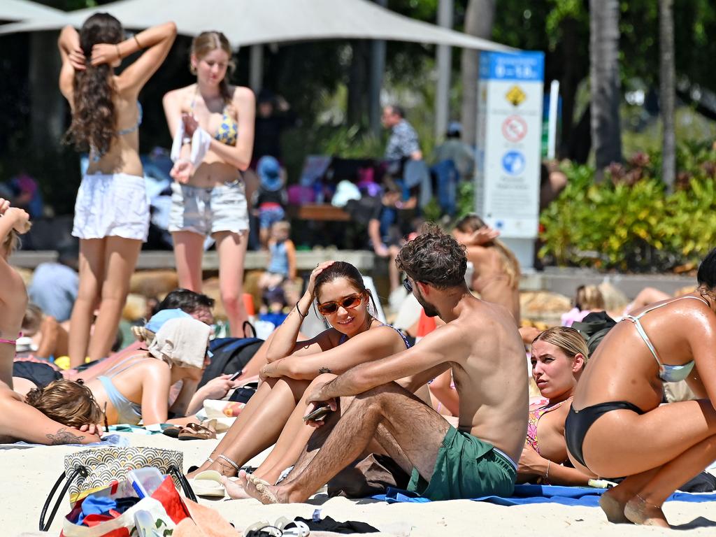
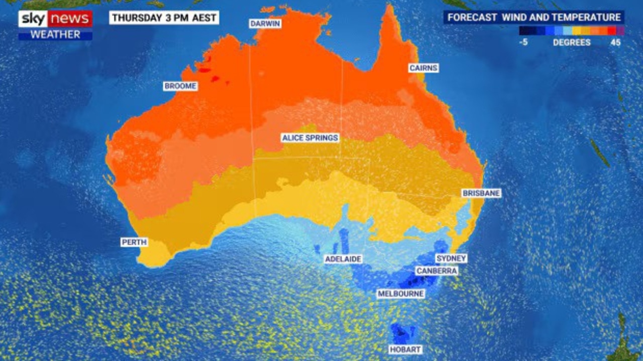
Further north, Brisbane is bracing for a scorching end to the week, with temperatures set to climb to 35C on Thursday, a staggering 9C above the October average.
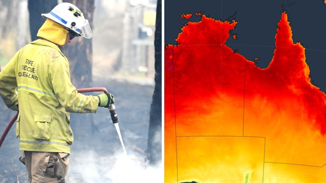
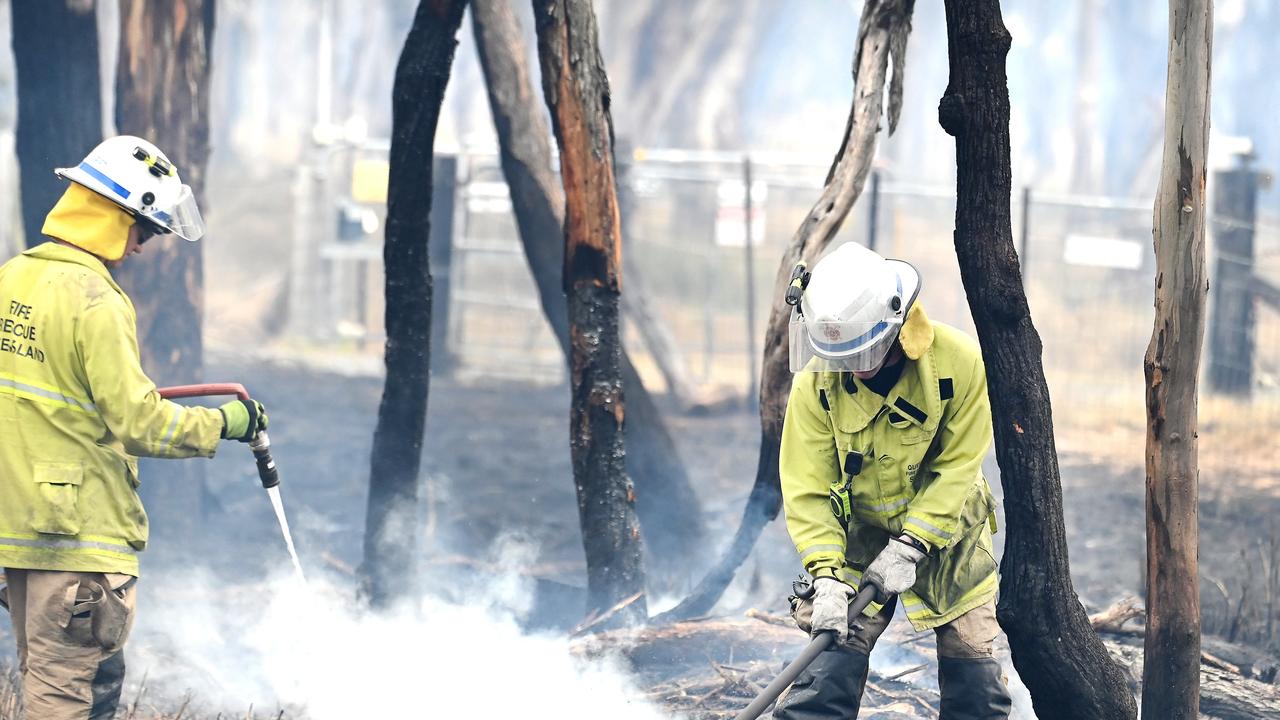
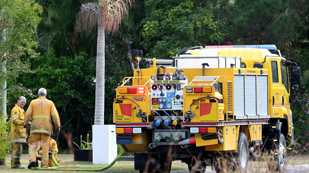
The city could also wake to a smoke haze from fires burning across Queensland, a reminder of the extreme conditions gripping much of the state.
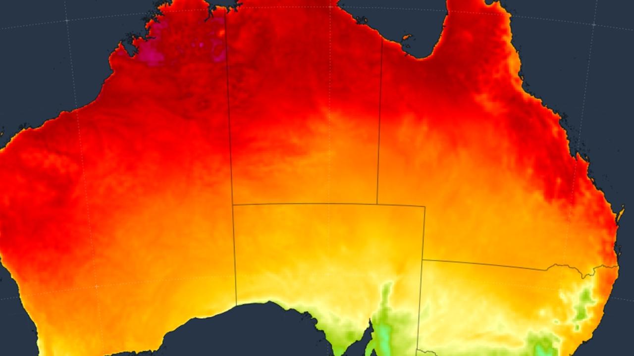
Temperatures across Queensland hit the highest levels in six months on Wednesday, prompting the Queensland Fire Department (QFD) to extend a total fire ban across South East Queensland from Thursday until next Tuesday.
The ban covers Brisbane, Ipswich, Logan, Somerset, Lockyer Valley, Scenic Rim, Noosa, Moreton Bay, Redland, Sunshine Coast, and Gold Coast local government areas.
“Current fire conditions are perfect for bushfires to ignite and spread quickly,” a QFD spokesman said.
“Under a local fire ban, all open fires are prohibited, and permits to light fires are suspended. We encourage extreme caution when using power tools and to have fire suppression equipment nearby.”
The hot, dry conditions are being driven by clear skies over much of the state, with Sky News senior meteorologist Alison Osbourne explaining that it was “much hotter than usual” for this time of year.
“The usual heat stress risks apply to vulnerable groups, the young, elderly, pregnant women and those with underlying health issues,” Ms Osbourne said.
Brisbane isn’t alone in facing the heat. Sydney reached 28C on Wednesday, while Canberra peaked at 25C.
In northern regions, Darwin was sweltering at 34C by 2pm, while Broome baked at 32C under sunny skies.
The extreme warmth contrasts sharply with the south. Victoria and Tasmania are contending with a cool south-easterly front that’s bringing showers and gusty winds.
Looking ahead to Thursday, Brisbane residents are in for another sizzling day up to 34C, while Sydney will reach 26C.
Canberra’s high will be 15C, and Melbourne and Hobart will remain cool at 15C and 17C.
Severe weather warnings are in place for damaging winds across the Snowy Mountains and eastern Victoria, while Tasmania faces minor flood risks from ongoing rainfall.
In the Northern Territory, the transition to the wet season continues, with Darwin under partly cloudy skies and 34C heat.
Western Australia will experience a mix of sun and showers, with Perth peaking at 27C.
On Friday, Brisbane residents can expect a high of 29C, with sunny skies and light winds.
It will be a sunny and windy day in Sydney, reaching a top of 24C.
Canberra can expect a partly cloudy day, with a maximum temperature of 19C.
Melbourne will continue its chilly streak, with a medium chance of showers in the morning and northwesterly winds, reaching a top of 19C.
Hobart residents can expect a partly cloudy day, with a medium chance of showers and a top of 16C.
Adelaide is forecast for a shower in the morning and a mostly sunny afternoon, with a maximum temperature of 20C.
Conditions will be cloudy in Perth on Friday, with a slight chance of a shower and light winds and a maximum temperature of 23C.
Darwin will be sunny in the morning, followed by a slight chance of a shower and thunderstorms in the afternoon and evening, reaching a top of 35C.
Storms are also possible in the far north tropics, adding to the nation’s varied spring weather.
Weatherzone meteorologists said the nation’s contrasting conditions were linked to a developing negative Southern Annular Mode, which shifts westerly winds northwards.
This pattern typically brings drier, warmer weather to the north and east, while cold fronts and low-pressure systems deliver rain to the southern states.